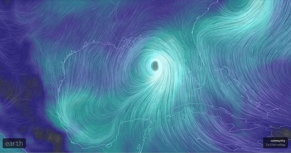
Tropical storm Hermine may end Florida’s record long hurricane drought


Florida’s luck has run out. After more than 11 years without a direct hit from a hurricane, what is likely to become Hurricane Hermine is predicted to make landfall in northwest Florida overnight on Thursday into Friday morning.
The most likely landfall location, according to the National Hurricane Center, is between Tallahassee and Tampa Bay.
The storm was upgraded to a hurricane shortly before 4 p.m. EDT, and will make landfall on Thursday night, delivering a life-threatening storm surge to coastal areas along and to the right of the storm’s center.
As of 4 p.m. EDT, Hermine was a Category 1 hurricane, with maximum sustained winds of 75 miles per hour.
These winds will push a surge of water toward the Florida coast, potentially leading to inundation of homes, businesses and beaches from Tampa northward to where the center of the storm makes landfall.

Image: NOAA
This part of Florida is extremely vulnerable to storm surge flooding in part because of the curved shape of the coastline, which forces the water to pile up onto the land.
Florida has been extraordinarily lucky during the past decade, going without a hurricane strike since Hurricane Wilma hit in October of 2005.
This is a record long timespan of nearly 4,000 days, exceeding the previous record by nearly five years. Typically, Florida is hit with a hurricane every 1.4 years, according to hurricane expert Brian McNoldy.
During the record long hurricane hiatus, about 2 million new residents moved to the state, many of whom have no memory of preparing for and experiencing a tropical storm or hurricane.
Storm surge threat
This storm comes as the National Hurricane Center (NHC) rolls out experimental storm surge maps and warnings designed to better warn the public about this hazard in particular.
A storm surge warning is in effect from Franklin County to Hernando County.
Here is what the NHC says on its website about the storm surge threat:
“The combination of a dangerous storm surge and the tide will cause normally dry areas near the coast to be flooded by rising waters moving inland from the shoreline.”

Experimental NWS storm surge guidance for Hurricane Hermine.
Image: NOAA
The NHC is warning of “a danger of life-threatening inundation within the next 12 to 24 hours along the Gulf Coast from Aripeka to Indian Pass.”
“The water could reach the following heights above ground if the peak surge occurs at the time of high tide,” the NHC says.
Destin to Indian Pass…1 to 3 feet
Indian Pass to Ochlockonee River…4 to 7 feet
Ochlockonee River to Keaton Beach…5 to 8 feet
Keaton Beach to Chassahowitzka…4 to 7 feet
Chassahowitzka to Aripeka…2 to 4 feet
Aripeka to Bonita Beach…including Tampa Bay…1 to 3 feet
Florida-Georgia line to Cape Fear…1 to 3 feet
Storm surge projections show maximum water levels could be even higher, up to 9 feet, in Taylor, Jefferson and Wakulla counties in Florida.
Fortunately, the Big Bend area of Florida is one of the more heavily forested parts of the state, but a storm surge of this magnitude could cause significant damage to coastal property.
In addition to the storm surge, heavy rain will be a concern across northern Florida, southern Georgia and the Carolinas, with the potential for more than 10 inches of rain in some locations.
Read more: http://mashable.com/2016/09/01/hurricane-hermine-florida-landfall/