Tropical cyclone Hermine: storm whips up waves and winds along east coast

The former hurricane was hundreds of miles off Massachusetts on Monday, as storm is expected to stall over water before weakening again

Former hurricane Hermine twisted hundreds of miles offshore in the Atlantic Ocean on Monday, creating large waves in some southern New England beach waters that lured in surfers despite the rough surf and rip currents that kept most beachgoers away on the last day of the long holiday weekend.
These are more seasoned surfers who live for the thrill of these waves, said Kim Buttrick, a meteorologist with the National Weather Service in Taunton, Massachusetts.
Hermines position on Monday morning about 260 miles south-east of Nantucket was creating 20ft waves about 55 miles south-east of the island, Buttrick said.
Hermine now a post-tropical cyclone was expected to stall over the water before weakening again.
Even as Hermine weakens, wind gusts of 30 to 50mph were expected across southern Rhode Island and south-eastern Massachusetts on Monday, Buttrick said.
Governors along the eastern seaboard announced emergency preparations. A tropical storm warning was in effect from New Yorks Long Island to Massachusetts.
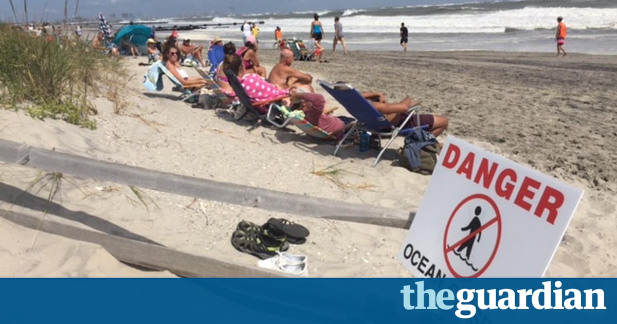
Whipping winds didnt keep some beach seekers from walking along the Jersey shore on Monday, but Labor Day vacationers quickly took to boardwalks as an aggressive high tide moved into the area late morning.
The waves eroded some of the shore, creating sand dune cliffs where kids climbed. Warnings of potentially dangerous riptides temporarily cleared the water on Monday morning, but a couple of dozen beachgoers and a handful of surfers returned to the water in Atlantic City by the afternoon. A rougher surf cleared portions of the beachfront.
MD Mahabub Khan, 50, has worked as a taxi cart pusher at the shore for 27 years and said he still attracted some business over the weekend, but the smaller crowds were noticeable.
People from New York and New Jersey are kind of stuck here [during bad weather], so they can still come, if forecasts dont play out as predicted, Khan said.
New York City closed its beaches on Monday because of rip currents, and the ban could extend into Tuesday, depending on weather conditions, officials said.
Hermine rose up over the Gulf of Mexico and hit Florida on Friday as a category 1 hurricane before weakening to a tropical storm across Georgia.
It has caused two deaths, inflicted widespread property damage and knocked out power to hundreds of thousands of people from Florida to Virginia.
As of 11am Monday, Hermines top sustained winds were steady at 70mph (110kph) as it moved north-west at 6mph.
Since sea levels have risen up to a foot because of global warming, the storm surges pushed by Hermine could be even more damaging, climate scientists say.
We are already experiencing more and more flooding due to climate change in every storm, said Michael Oppenheimer, a geosciences professor at Princeton University. And its only the beginning.
Michael Mann at Pennsylvania State University said the 1ft rise that New York City has experienced over the past century caused an additional 25 square miles and several billions of dollars of damage with Superstorm Sandy.
No flooding or other damage had been reported as of early Monday afternoon in some of the worst Sandy-hit areas, including Point Pleasant beach, Bay Head, Mantoloking and Brick.
On Saturday, high winds tipped over an 18-wheeler, killing its driver and shutting down the US 64 bridge in North Carolinas Outer Banks.
In Florida, a homeless man in Marion County was killed when he was hit by a tree that fell.
Read more: https://www.theguardian.com/us-news/2016/sep/05/tropical-storm-hermine-beaches-closed-hurricane